Google Maps for Mobile 5 introduced beginning of a new 3D
version 5 of Google Maps Mobile introduces a kind of 3D buildings of some major cities (for France, Marseille has only the privilege googlien ...). Can we really talk about 3D? not really (not exaggerate either), it is more elevation of the main buildings is proposed, which is not a negligible progress in the willingness to stick as close to "reality", including smartphones. The other advantage of this new version is also the offline viewing of the last places frequented by the software. A small idea of rendering software in this video presentation:
This time three new Mapped social networks. To begin this presentation that relates the share of social media services with the main uses of the Internet in every European country:
The other focuses on mapping multiple connections of Facebook users worldwide, the planisphere ets a very successful aesthetically, even if the readability is smaller:
The BBC website reveals an interactive map of the evolution of the percentage of Internet users by country and years. Indeed, the map is accompanied uneligne time that lets you navigate between the years 1998 and 2010, we can launch an animated map showing the changes. Note that this map is accompanied by the evolution of submarine cables, which remain an important infrastructure to develop Internet communications. Two remarks on this card: the percentage of discrimination thresholds do not exceed 25%, which is suitable in the early 2000s, much less for some northern countries passed 2005, the 25% threshold is not high thing and no longer completely relevant. So, in dragging the mouse over the States, we have more precise information for each of them, including the percentage of population connected to the total number of users. other hand, for the year 2010, it still lacks the data by country ... All data used in the preparation of this map are available on the site the ITU. Source: Jadlat
Vincos.it site which publishes since 2009 many world maps of social network services the most important country has posted his latest map, updated in 2010: It found the prevalence facebook, including the Americas, Europe and Africa, for which data have been collected. developments appear to be fewer since 2009:
QR codes in Paris, to experience augmented reality?
01.net tells the initiative of the collective Raspouteam who created and implemented twenty QR Codes in ceramics in Paris. These twenty places were the scene of major unrest in the city of Paris at different times (Municipality, the eve of World War I, May 68 ...). With the mobile can decrypt these codes, we obtain additional information on these events: text, images, videos. We find these places on a site optimized for reading with your smartphone. It is here, with this experiment, on the border of geocaching and augmented reality. A simple idea that requires little technical knowledge, a test to implement in an educational setting? A short video of the Making off of the device:
is a French company that offers Newscape Technology modelo 3D building, integrated into a card or a virtual globe, Google Earth way. Everything is available on Ipad, as shown in the following short video:
A short video of aerial images taken by a drone over New York, discover, and if the drones were going to multiply the aerial extent of more: a swap, Working to create ...
Since it is illegal to share on the Web, share the street! Unusual
is the motto of the project Drops Dead of the Berlin artist Aram Batholl . As the possibilities of exchanges between users, the vai réseuax P2P are becoming more restrictive, it proposes to exchange files, not online but on the street. How? Here is a rough translation of the presentation of the project site pop-up urban : '' Dead Drop 'is a sharing network files from peer to peer (P2P), anonymous and offline, taking place in public space. USB drives are built into the walls of the city, accessible to anyone. Everyone is invited to file or retrieve files by connecting a laptop to a "wall". Each USB drive is installed without data, with the exception of a text file explaining the project. 'Dead Drop' is an open project. If you want to install a key in your city follow the guide, then share pictures and the location of the facility. " ie Artist offers facilities USB keys to the city to échnager files, all in an artistic collaborative installation across Europe:
Small map presenting the different installation locations:
Taiwanese artist Yao-Bang has recreated the city of Shanghai in Using everyday objects in plastic. This work was commissioned by Converse, which supports Taiwanese artists. One can discover bt the different stages of the installation from this webpage. The artist identifies objects that look like real or symbolic buildings in Shanghai, at a scale other ... also discover from this video:
23 aerial compared with their urban versionss modeled in Google Earth
Example Pittsburgh
Google Earth Blog we propose very interesting a comparison between air and phtographie 3-D modeling in Google Earth. Indeed, starting from this slide show of aerial photographs around 23 major cities published in the Huffington Post , you can download a KMZ file which incorporates those 23 shots but from Google Earth and 3D models, keeping closest to the angles of views. This allows a comparison quite interesting about the relationship between photographs you 3D model. Through this work, GE blog has also realized the mistakes made by the drafters of the slide show ... Ticket to read!
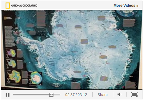
A small video about the map resources of National Geographic and how it is manufactured. Informative and a different use of computer tools for the design of paper maps PS: I want the same printer! video is available at this address .
Wikileaks is at the heart of the media storm after revelations about the multiple views and the gaze of American diplomats over the rest of the planet. Besides the ethical problems that these revelations pose, a problem reading these notes are the extreme heterogeneity of their remarks, affecting many countries and leaders, not necessarily any particular order, which adds to the confusion of words and could raise doubts about the validity such information. Nature abhors a vacuum, it became necessary to classify such information by country is about. Thus, one can discover a world map featuring the appearance of a distribution of information according to Wikileaks states. On the website of El Pais, however, it parallels the number of cables sent to and Whashington the date of such shipments. We are dealing here with a quantitative, not based on the number of disclosures made by the site, but based on the total number of official information sent from the U.S. embassy to the capital. The map therefore implies a proportional relationship between the number of cables and the amount of information revealed by Wikileaks. If you are in a clear and costed report on trade between embassies and country of origin, this type of mapping, even assuming very explicit links with the articles of Wikileaks, it not only adds to the confusion, the opacity of the subject, rather than clarify ?
To complete an article already published on mapping social networks, here is a new online mapping dynamic around Twitter and its use in real time. A world of tweet s offers a world map that shows the major trends of use of twitter as a function of geolocation of its users. the intensity of the number of tweets around the world can be observed real time or in the form of flat areas of heat diffusion (Heatmap) or in the form of clouds of smoke. (Smoky Cloud). The increase the number of tweets is symbolized by an animation simulating the rain. The analogy of a weather map is fairly obvious, but it does not seem particularly justified. effects made offer little to the overall readability of the card is showing the world map so that areas most sensitive to Twitter .. The most important added value lies in the update in "real time" data, which gives dynamism to the world map. It is supplemented by computer graphics sets updated regularly on the number of tweets exchanged, depending on their location ... The tool is very visual, but does not sufficiently precise to generate a complete analysis. It gives the temperature of the uses of twitter at some point in a given space.
the occasion of the International Climate Change Conference in Cancun, Google has launched a new tool: Google Earth Engine. It allows monitoring and measurement changes in terrestrial environment, worldwide. It offers the ability to view satellite images of rather old at strategic points of the changing environment, both natural, but also across states, countries in the developing world. it relies on several data sets including data 25-year Landsat or MODIS data very reactive. How does this work on? Simply visit this page , then select catalog data elements that you want displayed in the "Workspace" Workspace. This latter has two major advantages: each layer is accompanied by a timeline that lets you see older images, for comparison , it also offers opportunities to overlay layers of data, although obviously, you can mix and play on these two aspects. Finally, the tab "Map Gallery" allows you to view data directly through the plug-in for Google Earth.
past three days, the new version Google earth beta, sixth name is available for download. This new version offers three main types of innovations:
New 3D integration: almost 80 million trees have been modeled. Each species was listed, the result is available on a specific page. We discover and efforts to reforest the city centers of large cities ...
Google Earth program now includes the "Street View" which for now remains the exclusive Google Maps. We can take charge perosnnage Orange Pegman "and" wander "through 360 degrees in landscapes reconstructed. Another method is to parcouriri modeled the streets of cities along the ground, as if there was a pedestrian potential.
The software now includes satellite images and many more older, which helps to refine the comparisons and reading between two images. In some capitals, like Paris, the airline phtographies were also enriched.
What brings these new, branded verion 6? will increase the realism of the situations is clearly displayed on the one hand pat import mode "street view" which gives the impression of visiting a street in al perspective of a pedestrian, printing facilitated by the use the small orange character, even if it just turns on itself in an image that is not very recent ... What about the modeling of trees? If it shows green spaces in cities, the interest appears limited, as it questions the fragmented character modeling offers something for Sustainable Development, Green in connection with the image the company wants to give. Finally, the main interest is the integration of historical content, which permmetent refine the analysis ...


